Renewable Project Services
Overview
High-Resolution Asset Inspections
Aerial Vegetation Management
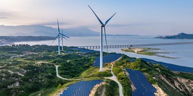
Sky Terra delivers specialist aerial solutions to support the operation, maintenance, and long-term sustainability of solar farms, wind farms, and hybrid renewable installations. Using advanced DJI Agras platforms, high-resolution sensors, and 3D LiDAR reconstruction technology, we help operators enhance safety, reduce costs, and maintain full compliance across their sites.
Aerial Vegetation Management
High-Resolution Asset Inspections
Aerial Vegetation Management
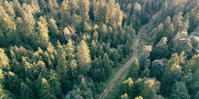
Targeted drone spraying and spreading for managing weeds, grasses, and regrowth around solar arrays, turbine bases, cable corridors, fencelines, and access roads. Our aerial approach eliminates soil compaction, reduces manual labour, and keeps sites compliant and low-risk year-round.
High-Resolution Asset Inspections
High-Resolution Asset Inspections
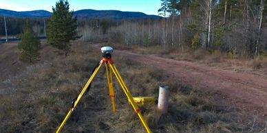
3D LiDAR Mapping & Digital Reconstruction Models
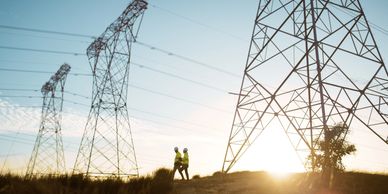
Rapid, detailed inspections of solar panels, wind turbine surrounds, substations, transformers, drainage systems, cable runs, fencing, and erosion zones. Our drones capture faults, changes, and structural concerns without shutdowns or personnel exposure to hazardous areas.
3D LiDAR Mapping & Digital Reconstruction Models
3D LiDAR Mapping & Digital Reconstruction Models
3D LiDAR Mapping & Digital Reconstruction Models
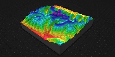
Advanced LiDAR scanning produces accurate 3D terrain models, elevation profiles, and structural reconstructions for renewable infrastructure. These models support site planning, earthworks evaluation, erosion tracking, vegetation encroachment analysis, infrastructure upgrade planning, and compliance documentation. LiDAR offers survey-grade accuracy, even in low-light or vegetated conditions.
Environmental & Compliance Monitoring
3D LiDAR Mapping & Digital Reconstruction Models
Environmental & Compliance Monitoring

Multispectral and RGB imaging to assess vegetation health, erosion risk, water flow, habitat impacts, and restoration performance. Reports support environmental audits, regulatory submissions, and long-term site stewardship.
GIS Mapping & Spatial Analysis
3D LiDAR Mapping & Digital Reconstruction Models
Environmental & Compliance Monitoring
High-resolution mapping for terrain modelling, layout planning, emergency-response mapping, and maintenance zone optimisation. All outputs integrate seamlessly with GIS and asset-management systems commonly used across the renewable sector.